✨ New Arrivals Just Dropped!Explore
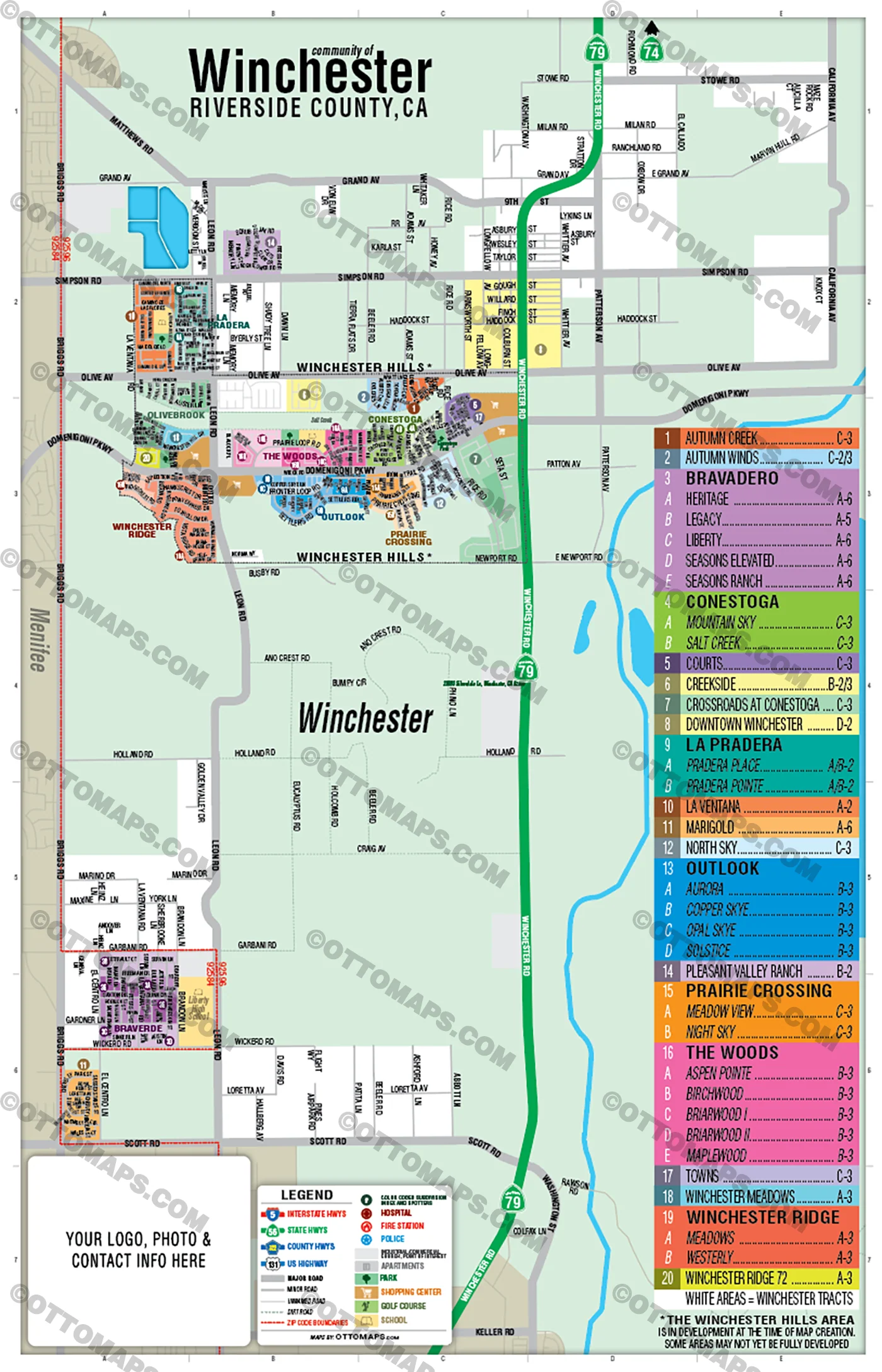
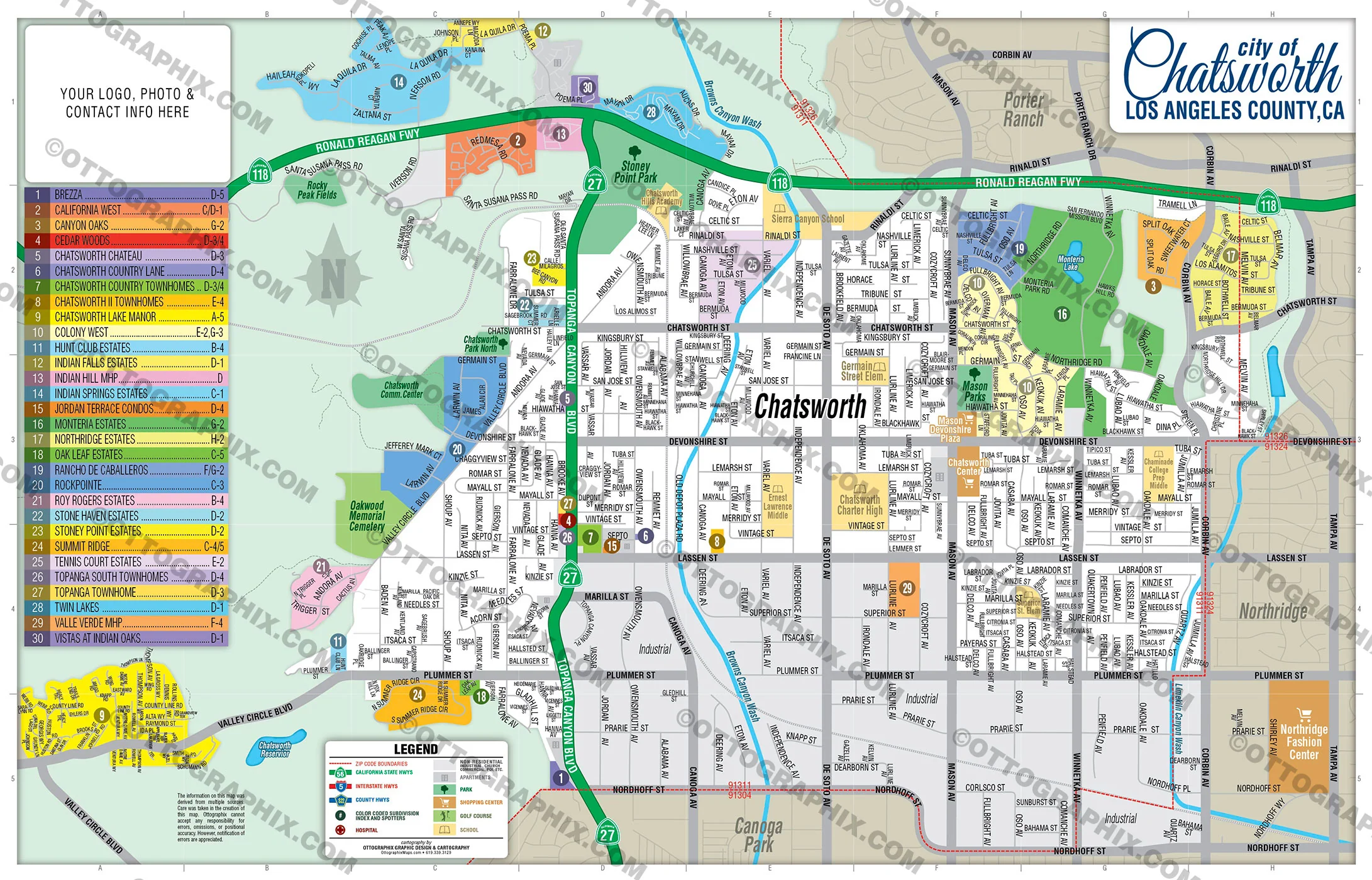
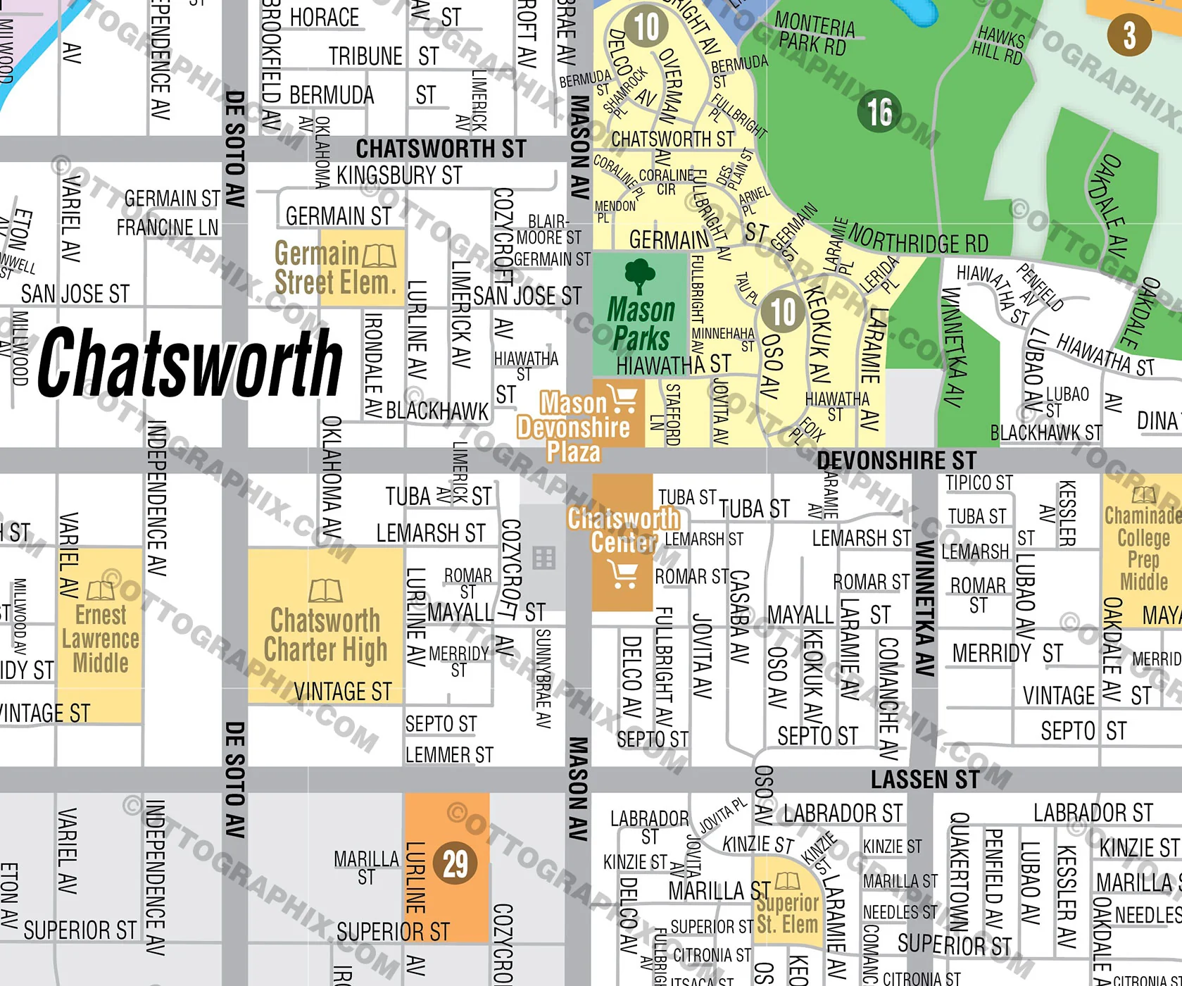
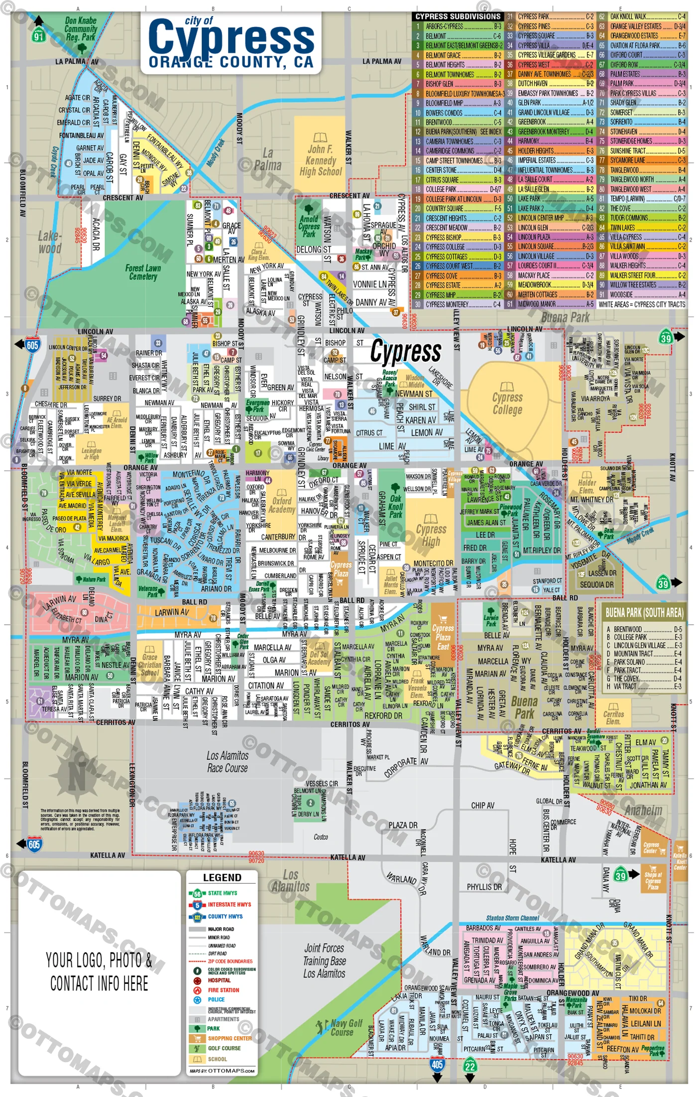
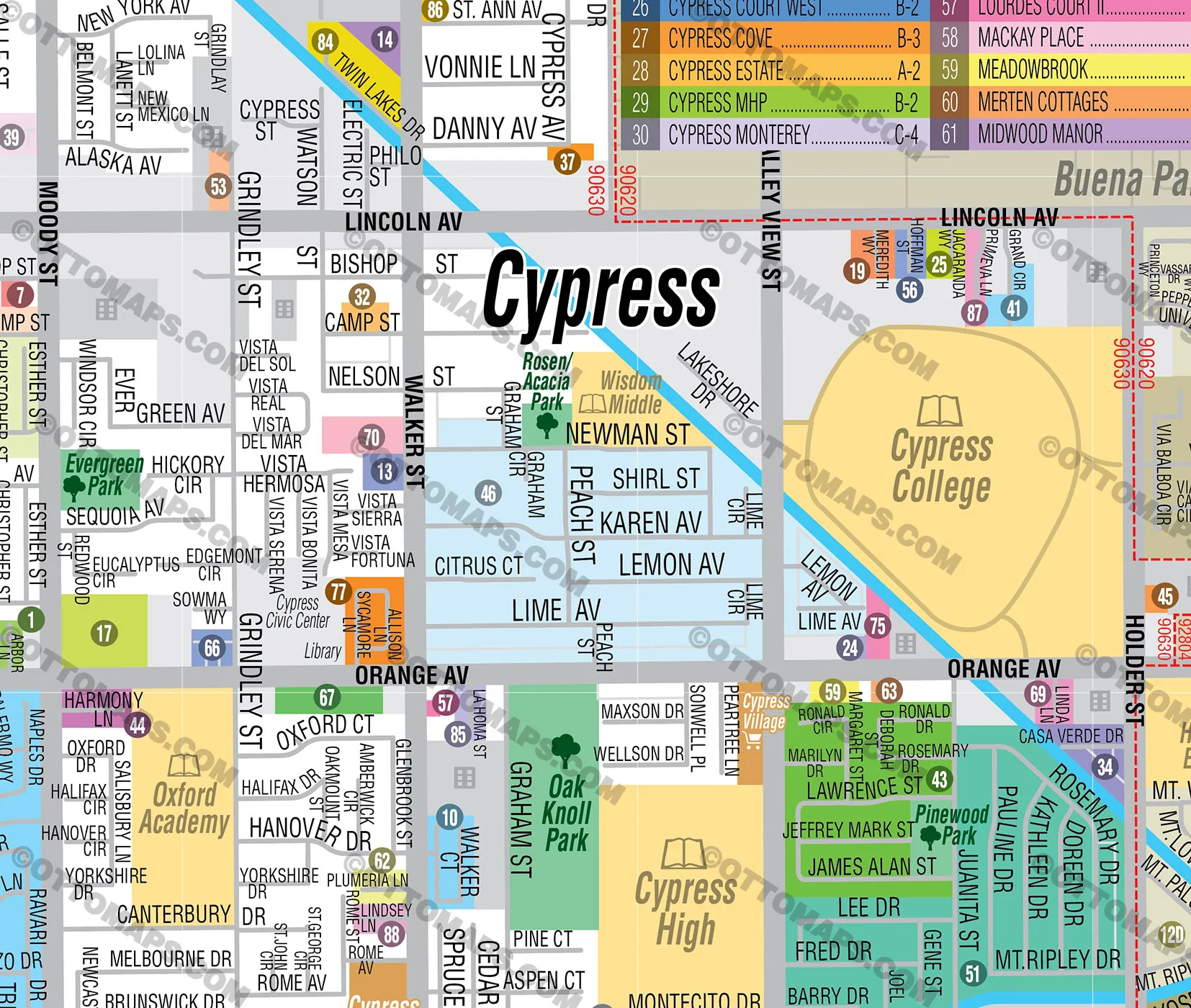
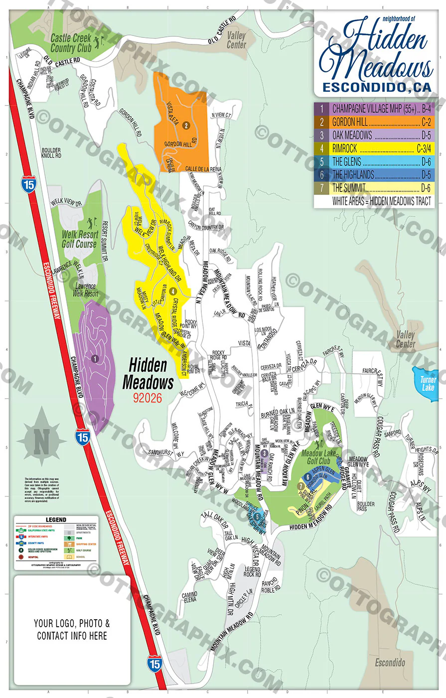
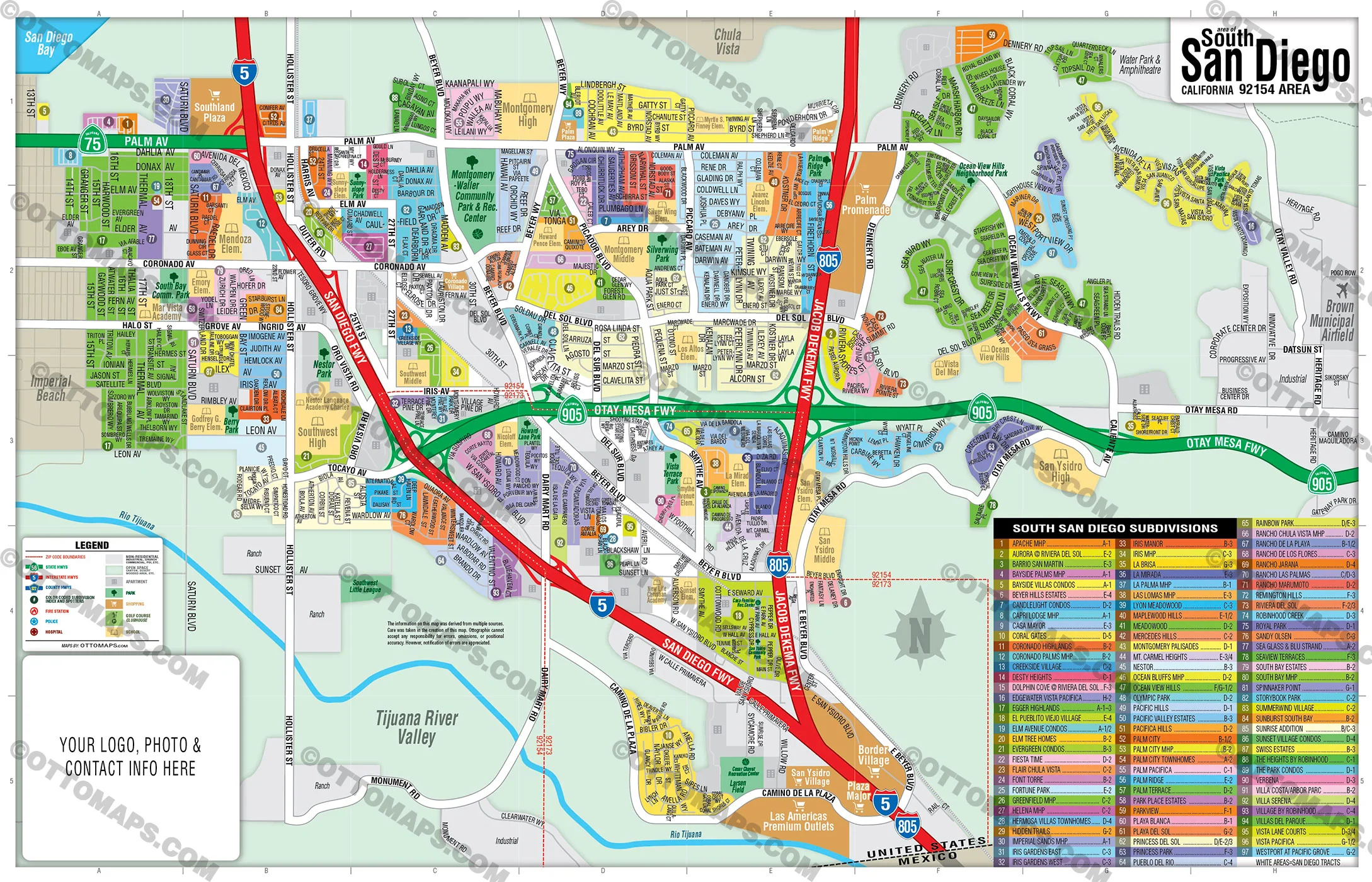
Winchester Map, Riverside County, CA - FILES - PDF and AI, editable, vector, royalty free
PURCHASE INCLUDES:
- PDF Files - with Company Branding Box and without
- Adobe Illustrator Files and fonts (layered, editable)
- 11”x17” Vector File - enlarged or reduced to any size with out loss of quality
- Customization: Turn map layers on or off. Easily change Fonts and Colors
- Royalty Free / All Reproduction Rights Granted (not for resale)
- Prints not included, recommend VistaPrint
- NO SALES TAX!
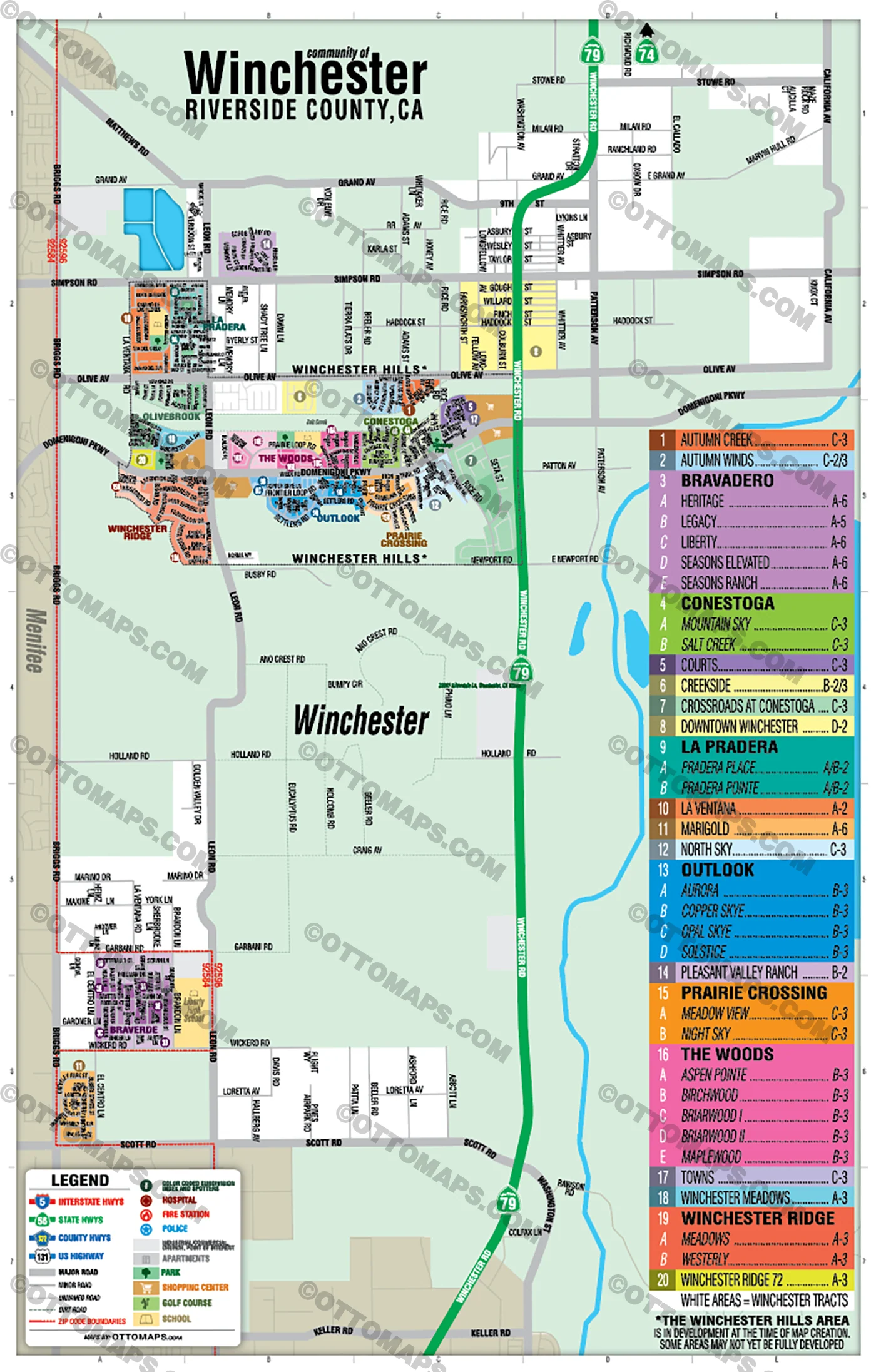
COMMUNITIES:
- ASPEN POINTE
- AURORA
- AUTUMN CREEK
- AUTUMN WINDS
- BIRCHWOOD
- BRAVADERO
- BRIARWOOD I
- BRIARWOOD II
- CONESTOGA
- COPPER SKYE
- COURTS
- CREEKSIDE
- CROSSROADS AT CONESTOGA
- DOWNTOWN WESTCHESTER
- HERITAGE
- LA PRADERA
- LA VENTANA
- LEGACY
- LIBERTY
- MAPLEWOOD
- MARIGOLD
- MEADOW VIEW
- MEADOWS
- MOUNTAIN SKY
- NIGHT SKY
- NORTH SKY
- OPAL SKYE
- OUTLOOK
- PLEASANT VALLEY RANCH
- PRADERA PLACE
- PRADERA POINTE
- PRAIRIE CROSSING
- SALT CREEK
- SEASONS ELEVATED
- SEASONS RANCH
- SOLSTICE
- THE WOODS
- TOWNS
- WESTERLY
- WINCHESTER MEADOWS
- WINCHESTER RIDGE 72
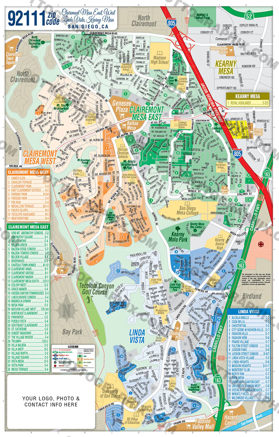
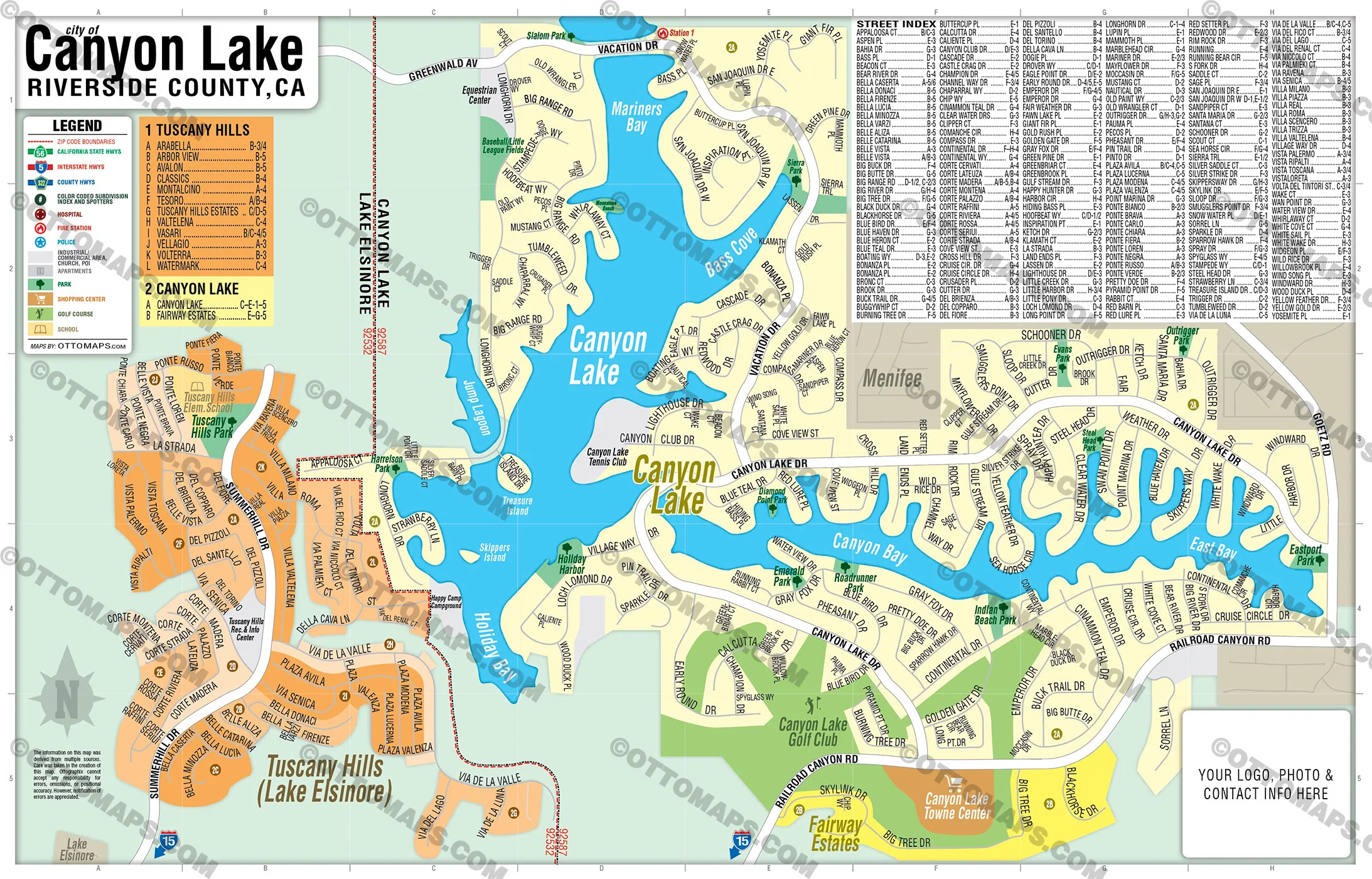
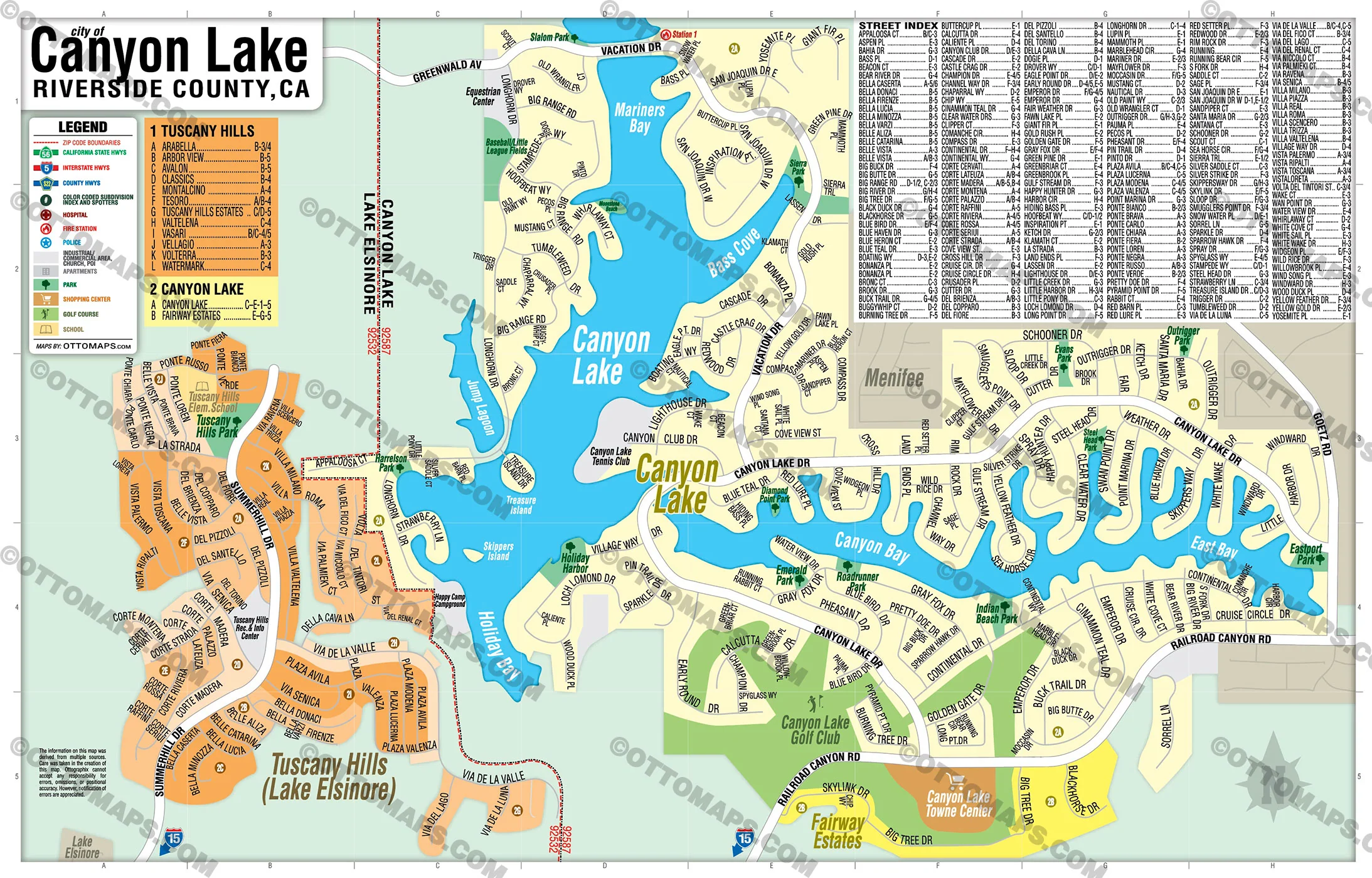
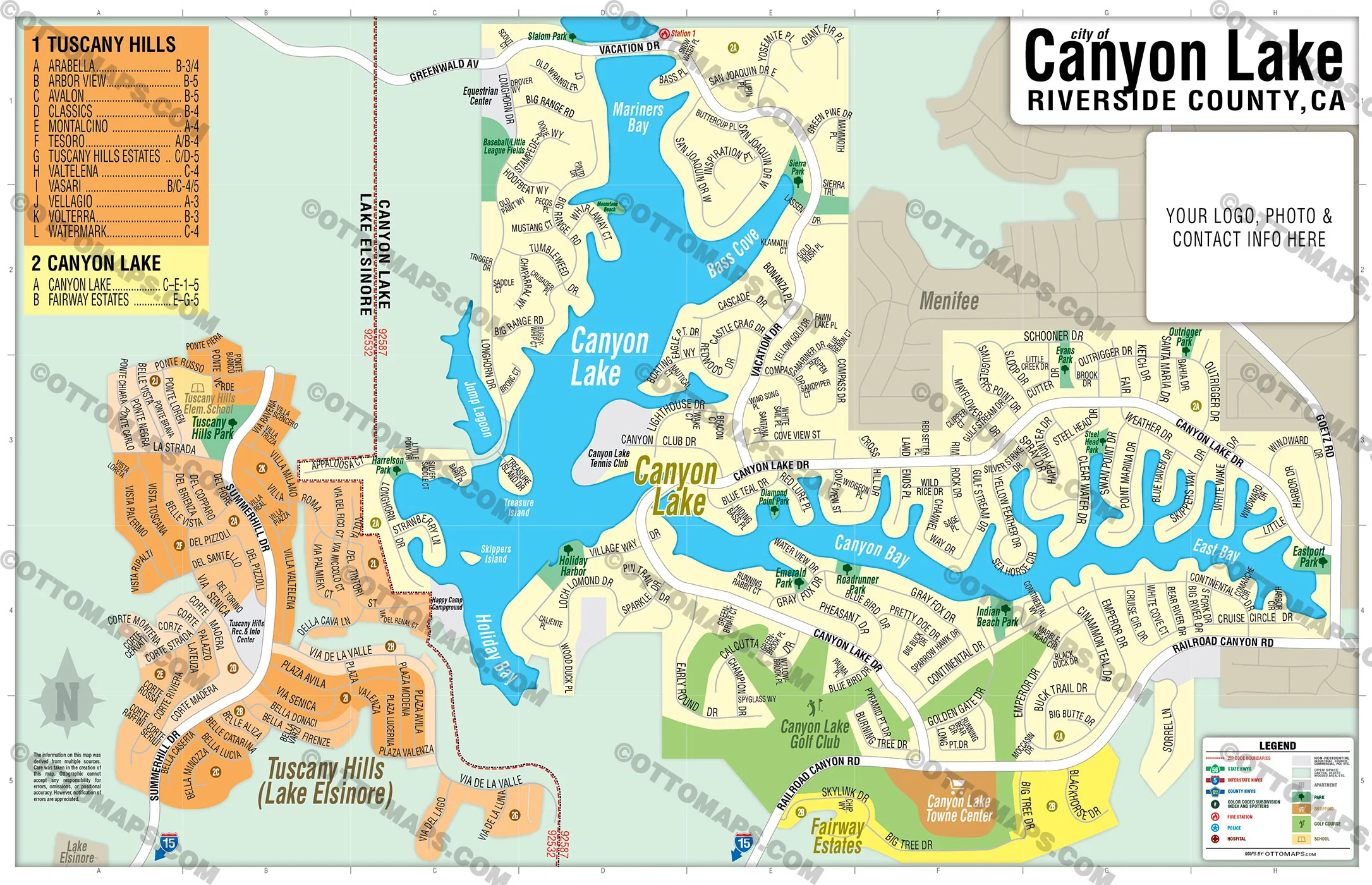
DETAILS:
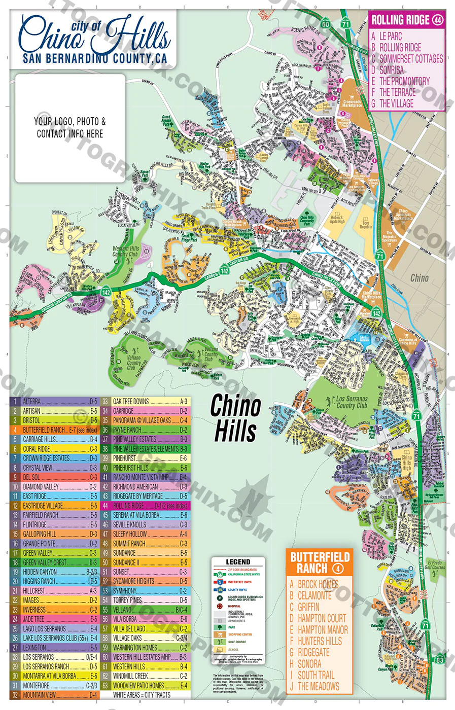
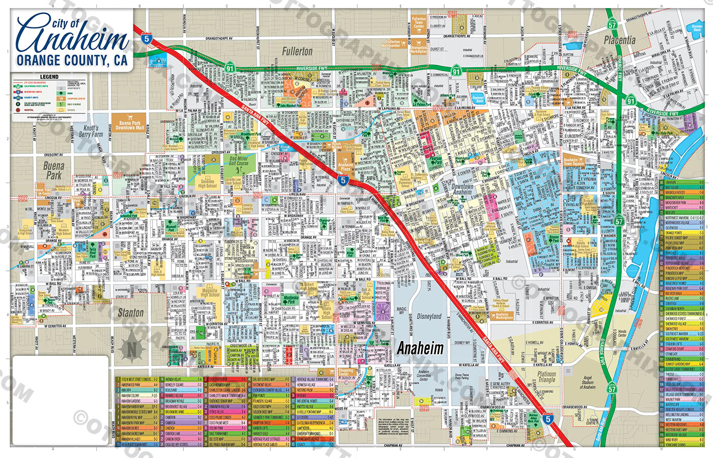
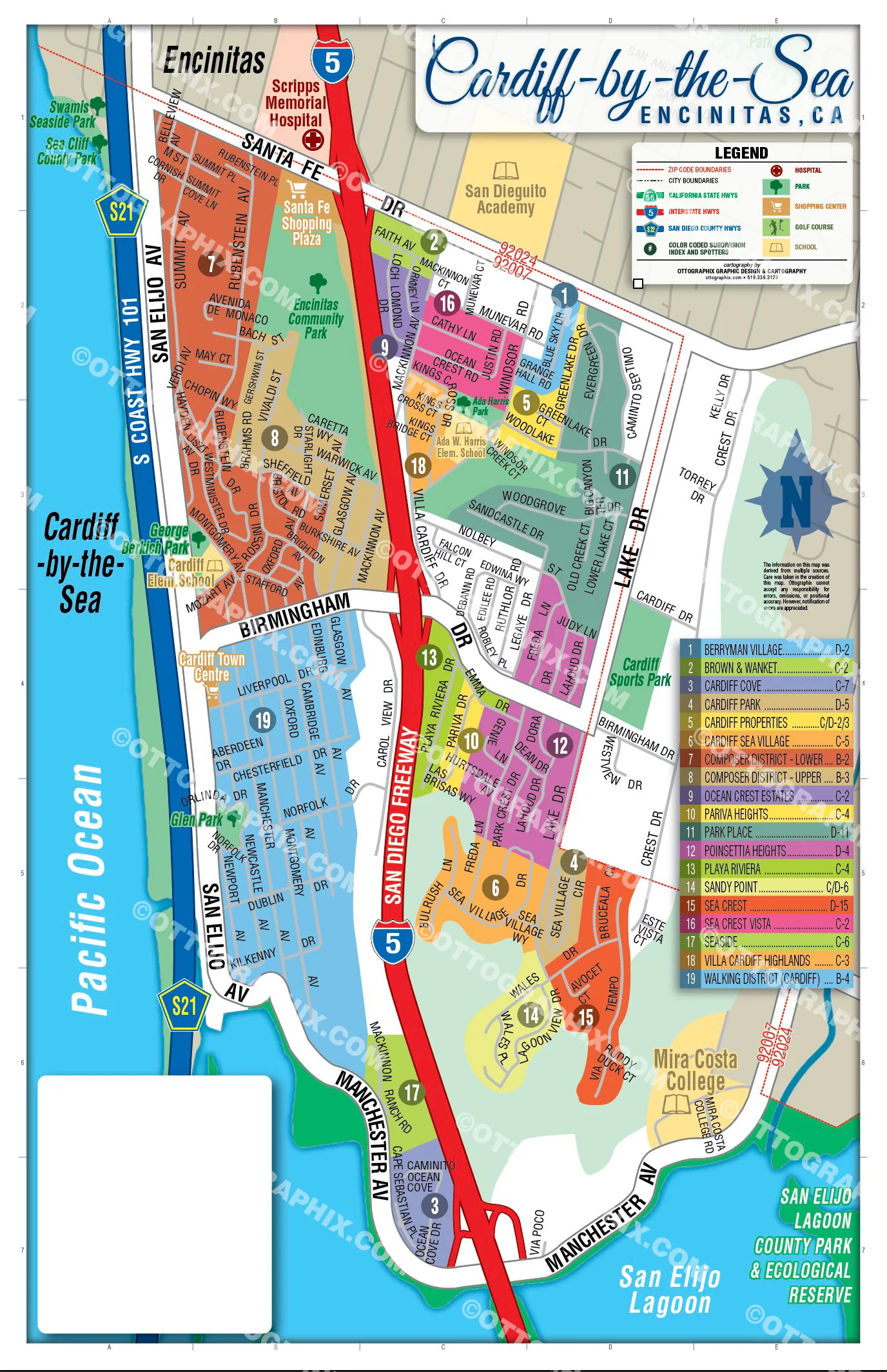
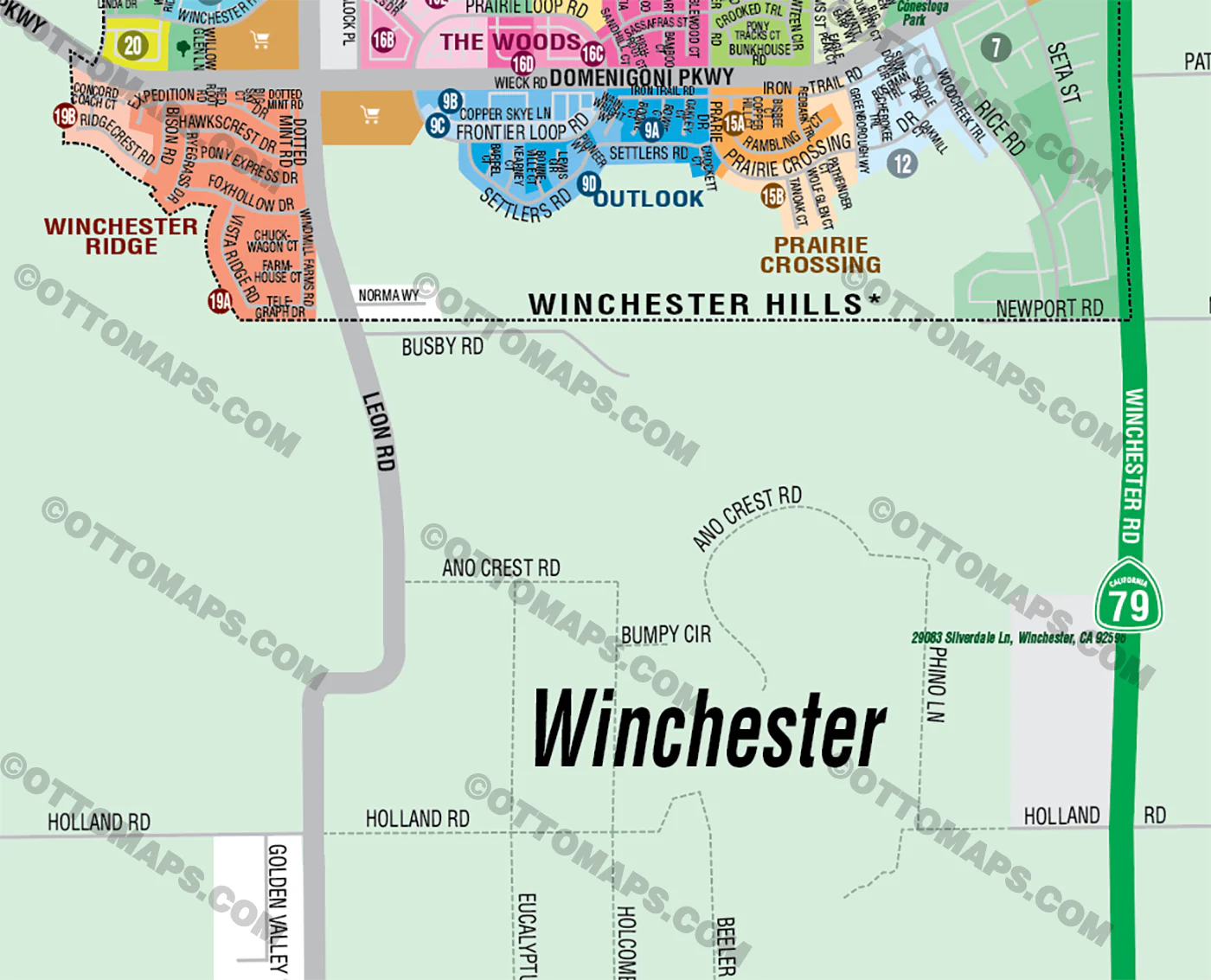
- Subdivision/Tract Boundaries and Index
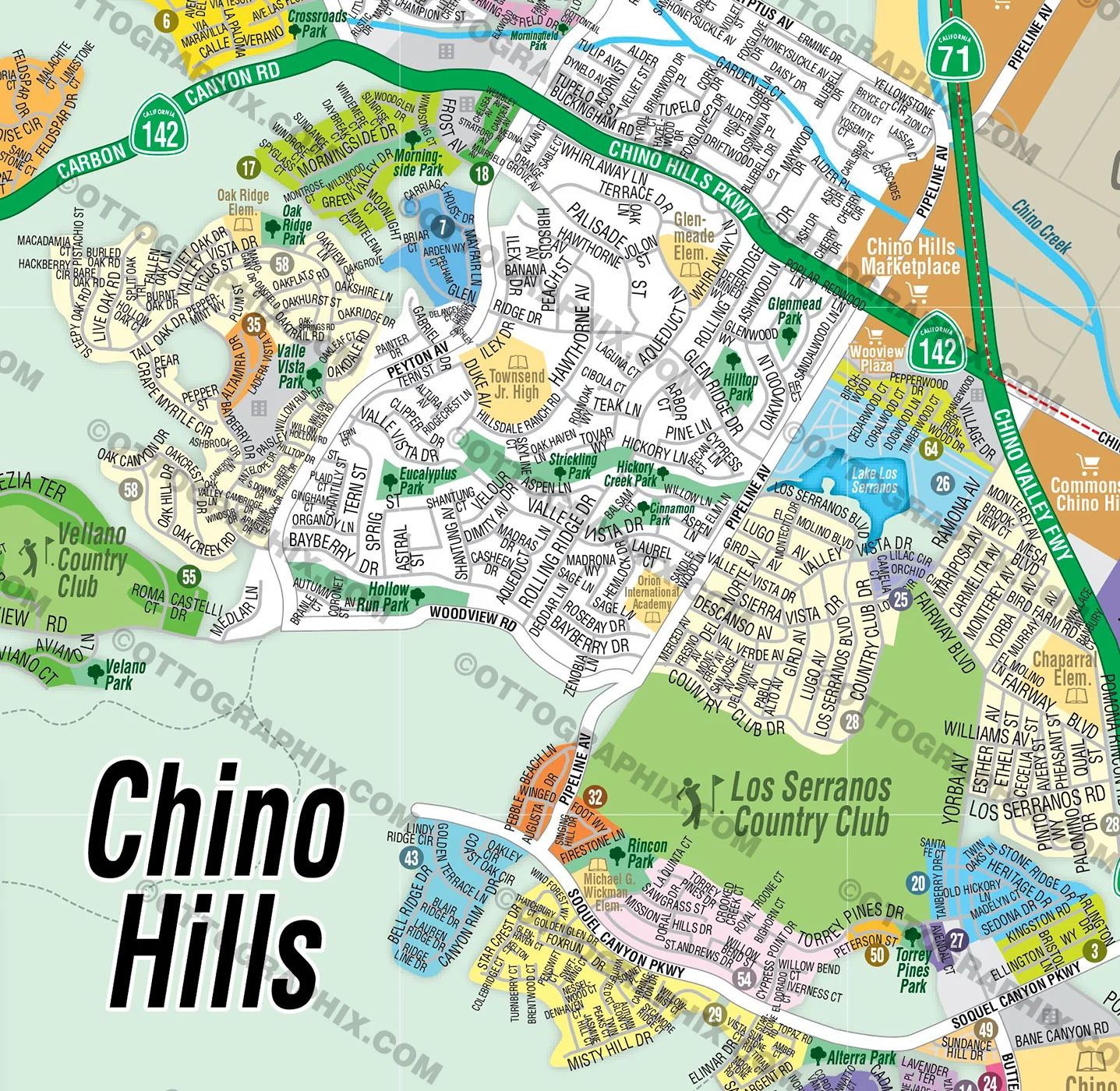
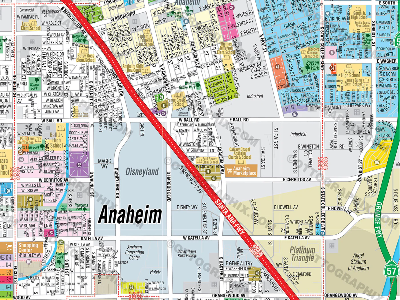
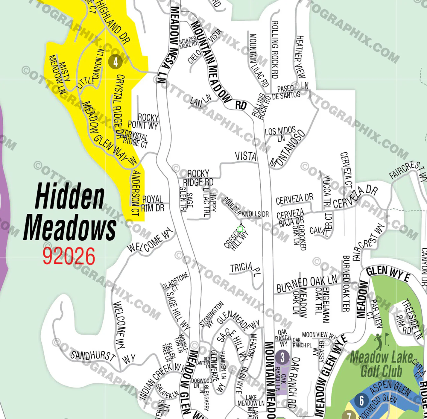
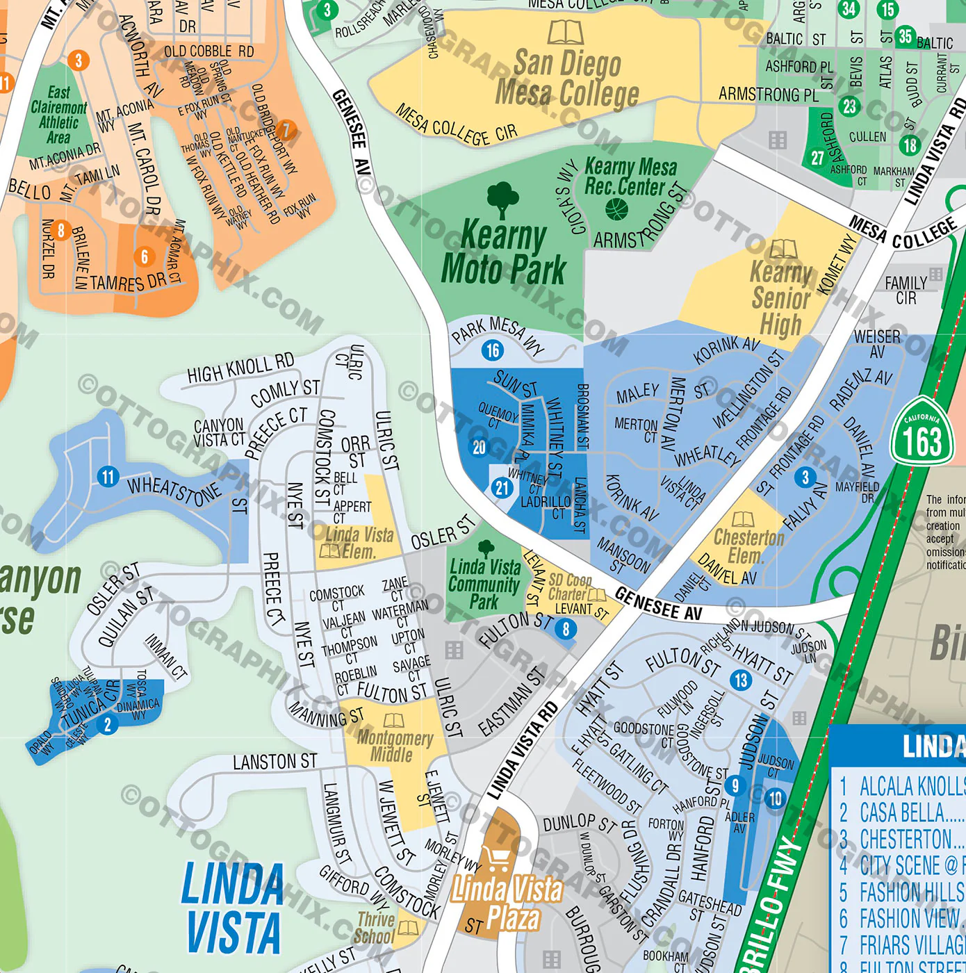
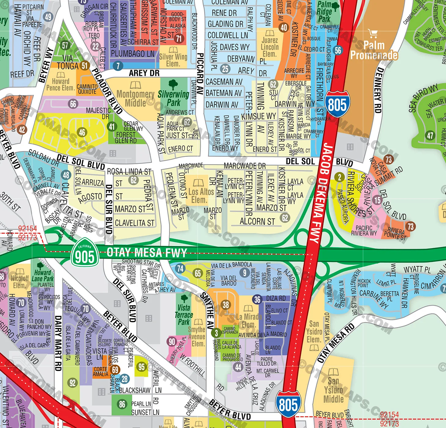
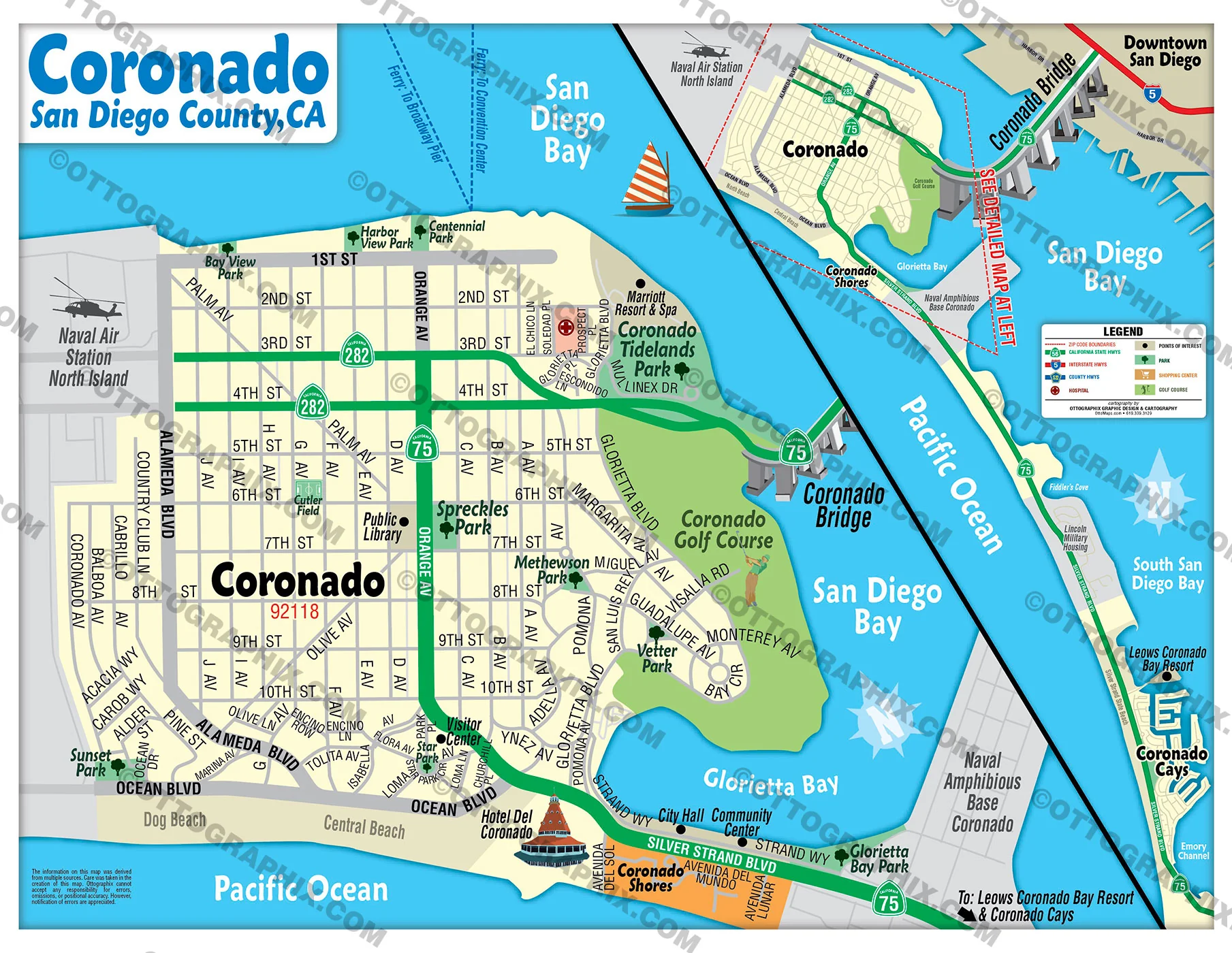
- Full Street Detail
- Recreation Centers
- Parks
- Shopping Centers
- Golf Courses
- Schools
- Royalty Free
- Not for resale
- All reproduction rights granted
DISCLAIMER:
- The information on this map was derived from multiple sources. Care was taken in the creation of this map. Ottographix cannot accept any responsibility for errors, omissions, or positional accuracy. However, notification of errors are appreciated. If you find a mistake, Ottographix will fix it for no charge. Please contact us and we'll take care of it. https://www.ottographix.com/contact.html, 619.339.3129, [email protected]
- Maps are sold as-is. All necessary files are included for editing
- Additional customization is available from Ottographix at an additional cost. Please contact us for details and a free quote. http://www.ottographix.com/contact.html, 619.339.3129, [email protected]
$33.25
Original: $95.00
-65%Winchester Map, Riverside County, CA - FILES - PDF and AI, editable, vector, royalty free—
$95.00
$33.25More Images
Winchester Map, Riverside County, CA - FILES - PDF and AI, editable, vector, royalty free
PURCHASE INCLUDES:
- PDF Files - with Company Branding Box and without
- Adobe Illustrator Files and fonts (layered, editable)
- 11”x17” Vector File - enlarged or reduced to any size with out loss of quality
- Customization: Turn map layers on or off. Easily change Fonts and Colors
- Royalty Free / All Reproduction Rights Granted (not for resale)
- Prints not included, recommend VistaPrint
- NO SALES TAX!
COMMUNITIES:
- ASPEN POINTE
- AURORA
- AUTUMN CREEK
- AUTUMN WINDS
- BIRCHWOOD
- BRAVADERO
- BRIARWOOD I
- BRIARWOOD II
- CONESTOGA
- COPPER SKYE
- COURTS
- CREEKSIDE
- CROSSROADS AT CONESTOGA
- DOWNTOWN WESTCHESTER
- HERITAGE
- LA PRADERA
- LA VENTANA
- LEGACY
- LIBERTY
- MAPLEWOOD
- MARIGOLD
- MEADOW VIEW
- MEADOWS
- MOUNTAIN SKY
- NIGHT SKY
- NORTH SKY
- OPAL SKYE
- OUTLOOK
- PLEASANT VALLEY RANCH
- PRADERA PLACE
- PRADERA POINTE
- PRAIRIE CROSSING
- SALT CREEK
- SEASONS ELEVATED
- SEASONS RANCH
- SOLSTICE
- THE WOODS
- TOWNS
- WESTERLY
- WINCHESTER MEADOWS
- WINCHESTER RIDGE 72
DETAILS:
- Subdivision/Tract Boundaries and Index
- Full Street Detail
- Recreation Centers
- Parks
- Shopping Centers
- Golf Courses
- Schools
- Royalty Free
- Not for resale
- All reproduction rights granted
DISCLAIMER:
- The information on this map was derived from multiple sources. Care was taken in the creation of this map. Ottographix cannot accept any responsibility for errors, omissions, or positional accuracy. However, notification of errors are appreciated. If you find a mistake, Ottographix will fix it for no charge. Please contact us and we'll take care of it. https://www.ottographix.com/contact.html, 619.339.3129, [email protected]
- Maps are sold as-is. All necessary files are included for editing
- Additional customization is available from Ottographix at an additional cost. Please contact us for details and a free quote. http://www.ottographix.com/contact.html, 619.339.3129, [email protected]
Product Information
Product Information
Shipping & Returns
Shipping & Returns
Description
PURCHASE INCLUDES:
- PDF Files - with Company Branding Box and without
- Adobe Illustrator Files and fonts (layered, editable)
- 11”x17” Vector File - enlarged or reduced to any size with out loss of quality
- Customization: Turn map layers on or off. Easily change Fonts and Colors
- Royalty Free / All Reproduction Rights Granted (not for resale)
- Prints not included, recommend VistaPrint
- NO SALES TAX!
COMMUNITIES:
- ASPEN POINTE
- AURORA
- AUTUMN CREEK
- AUTUMN WINDS
- BIRCHWOOD
- BRAVADERO
- BRIARWOOD I
- BRIARWOOD II
- CONESTOGA
- COPPER SKYE
- COURTS
- CREEKSIDE
- CROSSROADS AT CONESTOGA
- DOWNTOWN WESTCHESTER
- HERITAGE
- LA PRADERA
- LA VENTANA
- LEGACY
- LIBERTY
- MAPLEWOOD
- MARIGOLD
- MEADOW VIEW
- MEADOWS
- MOUNTAIN SKY
- NIGHT SKY
- NORTH SKY
- OPAL SKYE
- OUTLOOK
- PLEASANT VALLEY RANCH
- PRADERA PLACE
- PRADERA POINTE
- PRAIRIE CROSSING
- SALT CREEK
- SEASONS ELEVATED
- SEASONS RANCH
- SOLSTICE
- THE WOODS
- TOWNS
- WESTERLY
- WINCHESTER MEADOWS
- WINCHESTER RIDGE 72
DETAILS:
- Subdivision/Tract Boundaries and Index
- Full Street Detail
- Recreation Centers
- Parks
- Shopping Centers
- Golf Courses
- Schools
- Royalty Free
- Not for resale
- All reproduction rights granted
DISCLAIMER:
- The information on this map was derived from multiple sources. Care was taken in the creation of this map. Ottographix cannot accept any responsibility for errors, omissions, or positional accuracy. However, notification of errors are appreciated. If you find a mistake, Ottographix will fix it for no charge. Please contact us and we'll take care of it. https://www.ottographix.com/contact.html, 619.339.3129, [email protected]
- Maps are sold as-is. All necessary files are included for editing
- Additional customization is available from Ottographix at an additional cost. Please contact us for details and a free quote. http://www.ottographix.com/contact.html, 619.339.3129, [email protected]