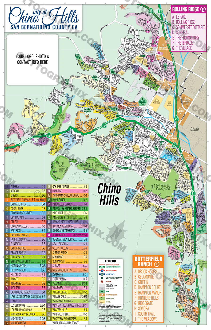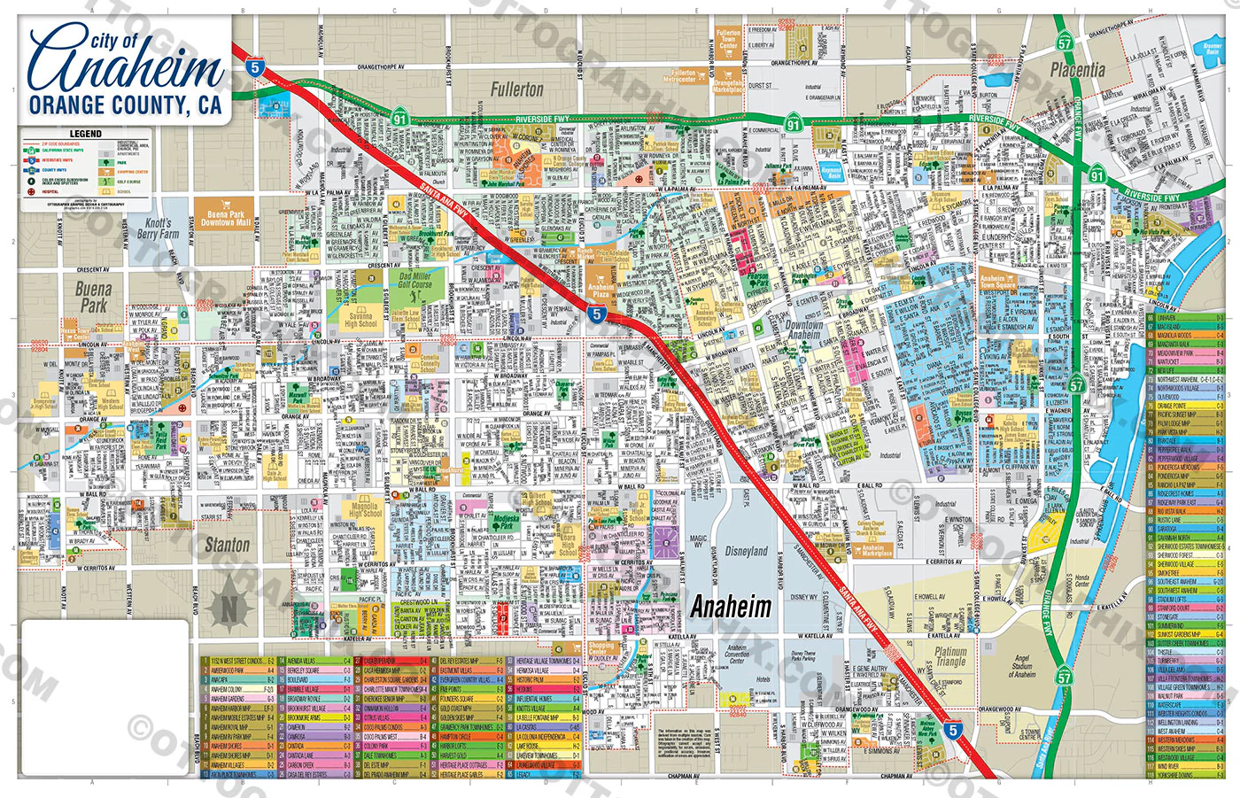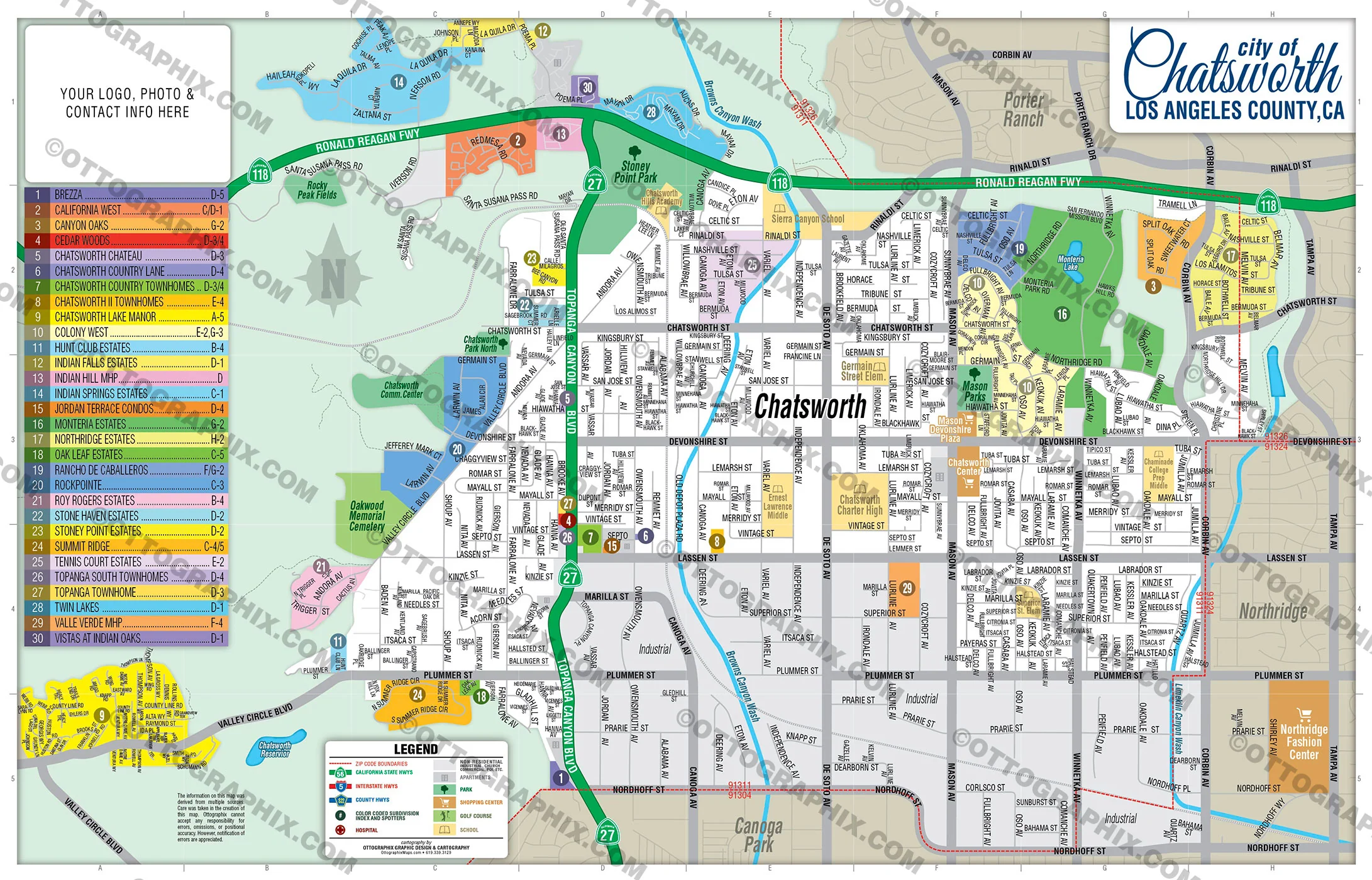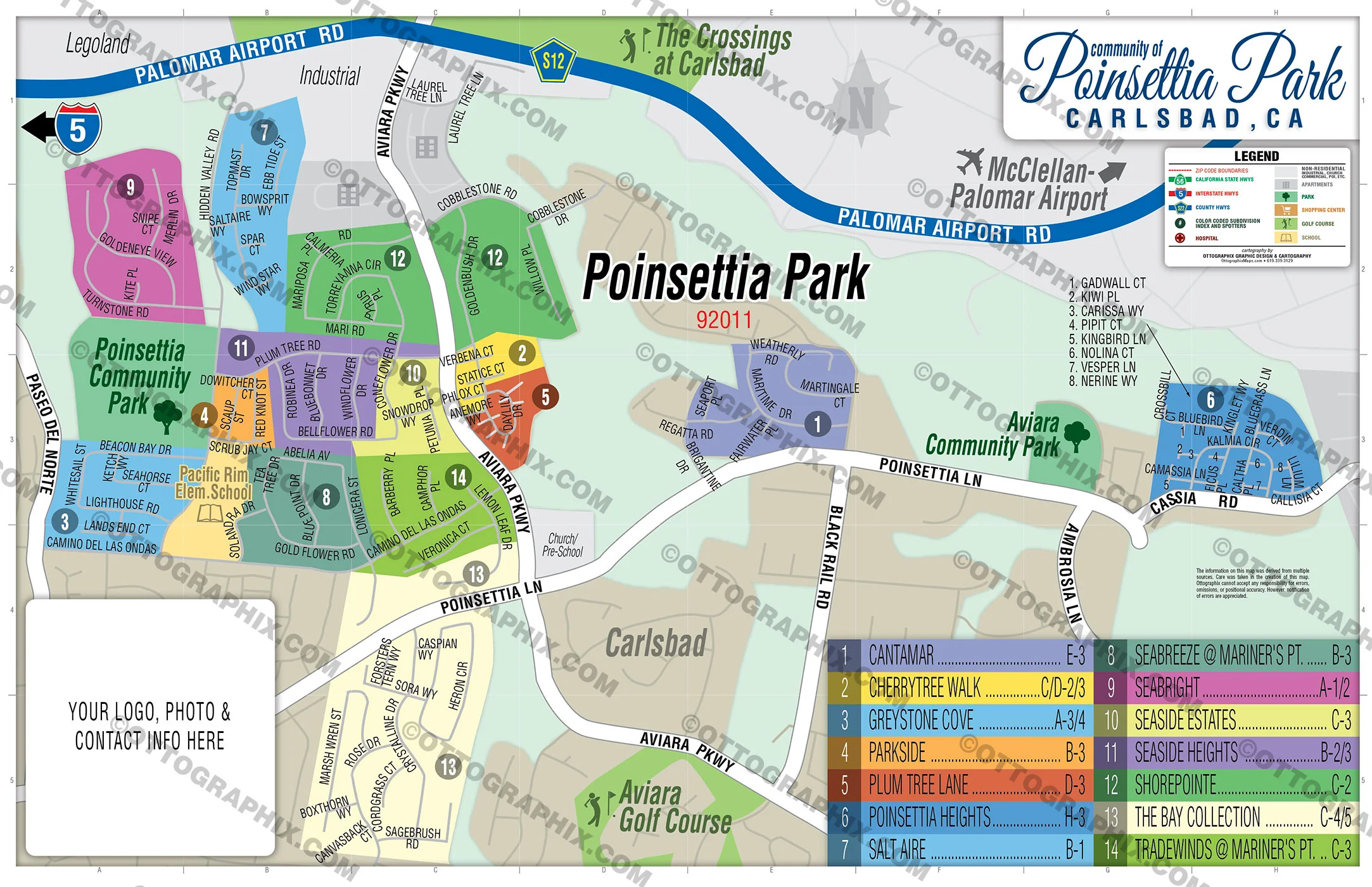
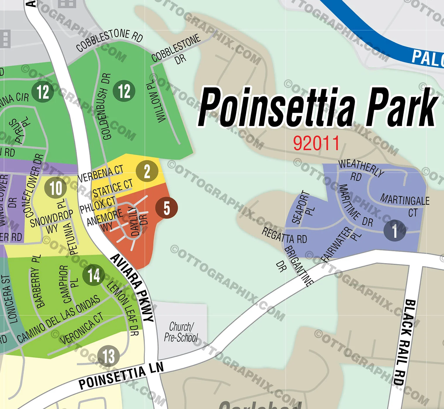
Poinsettia Park Map, San Diego County, CA - FILES - PDF and AI, editable, vector, royalty free
Poinsettia Park Map, San Diego County, CA - FILES - PDF and AI, editable, vector, royalty free
PURCHASE INCLUDES:
Ready-To-Use PDF with blank box for company branding, and
Layered, editable Adobe Illustrator CC file with fonts
SIZE: 11w x 17h - Vector Maps: enlarge or reduce to any size without loss of quality
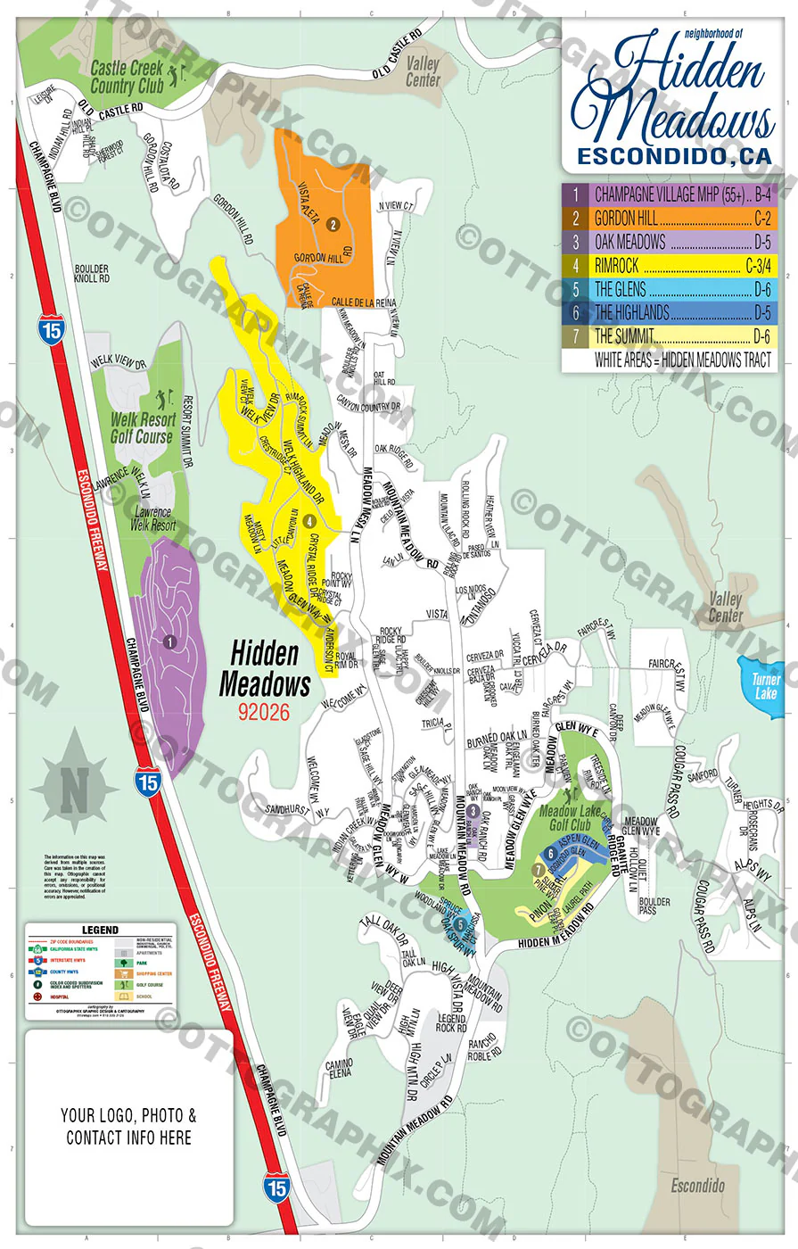
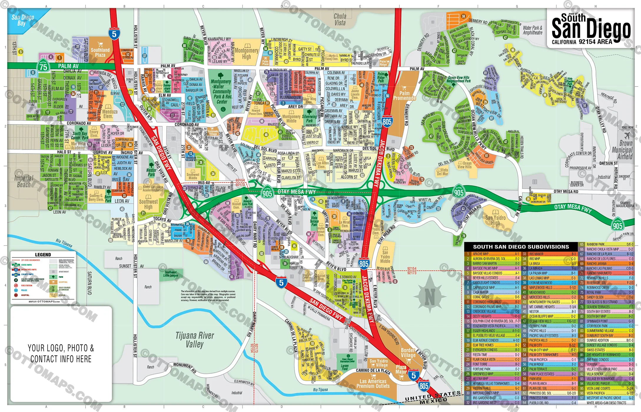
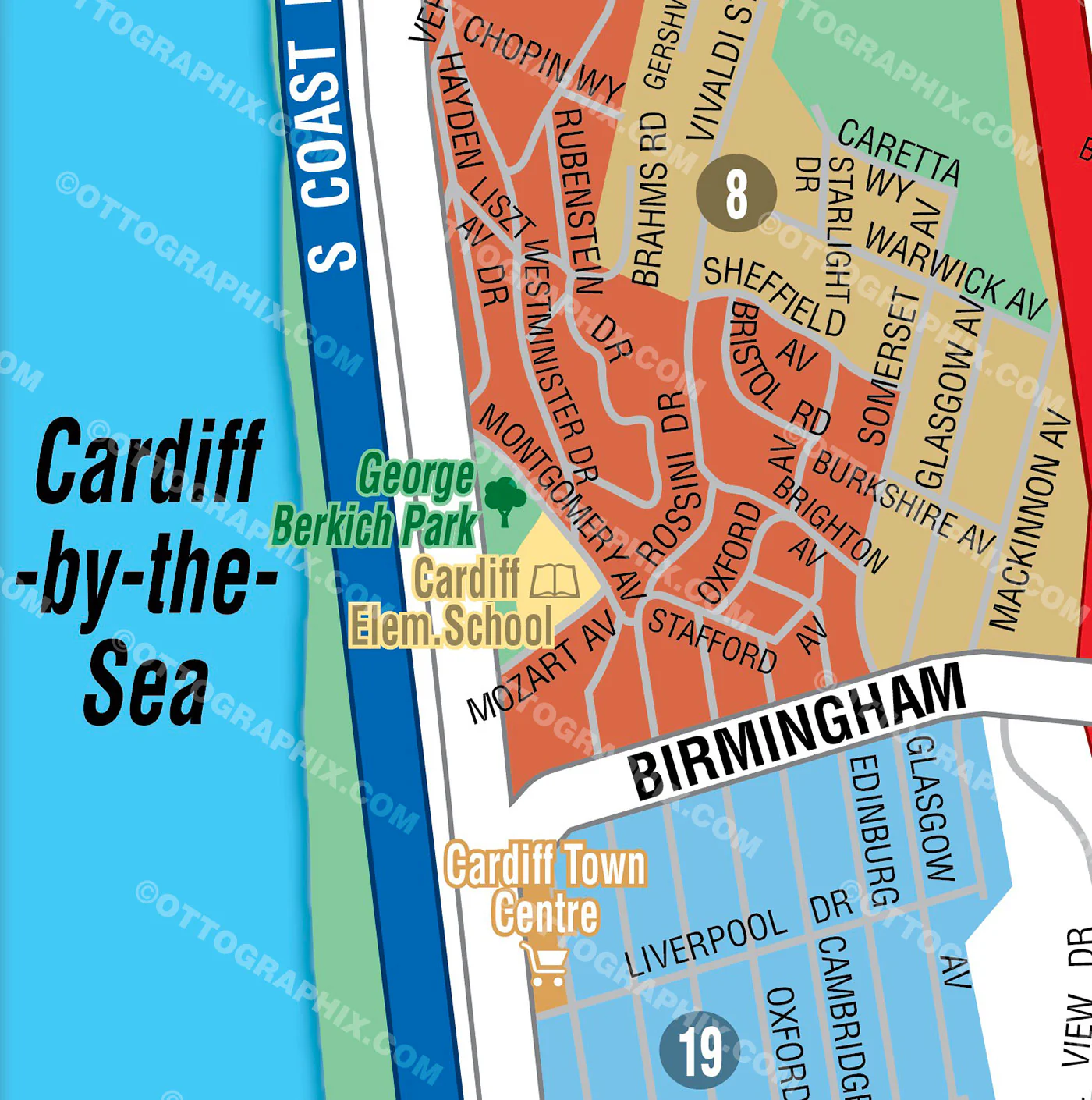
COMMUNITIES:
- CANTAMAR
- CHERRYTREE WALK
- GREYSTONE COVE
- PARKSIDE
- PLUM TREE LANE
- POINSETTIA HEIGHTS
- SALT AIRE
- SEABREEZE @ MARINER'S PT.
- SEABRIGHT
- SEASIDE ESTATES
- SEASIDE HEIGHTS
- SHOREPOINTE
- THE BAY COLLECTION
- TRADEWINDS @ MARINER'S PT.
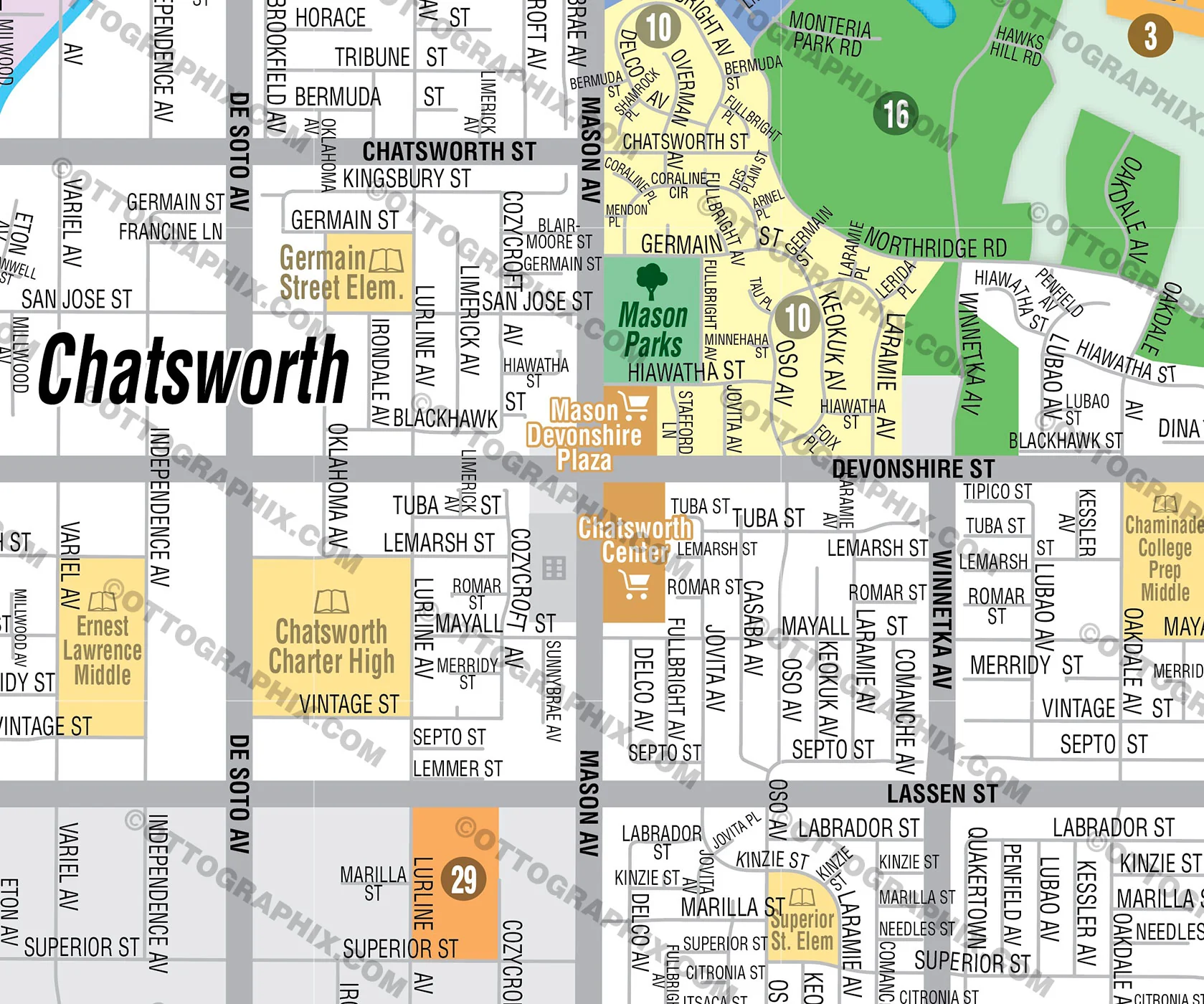
CONTAINS:
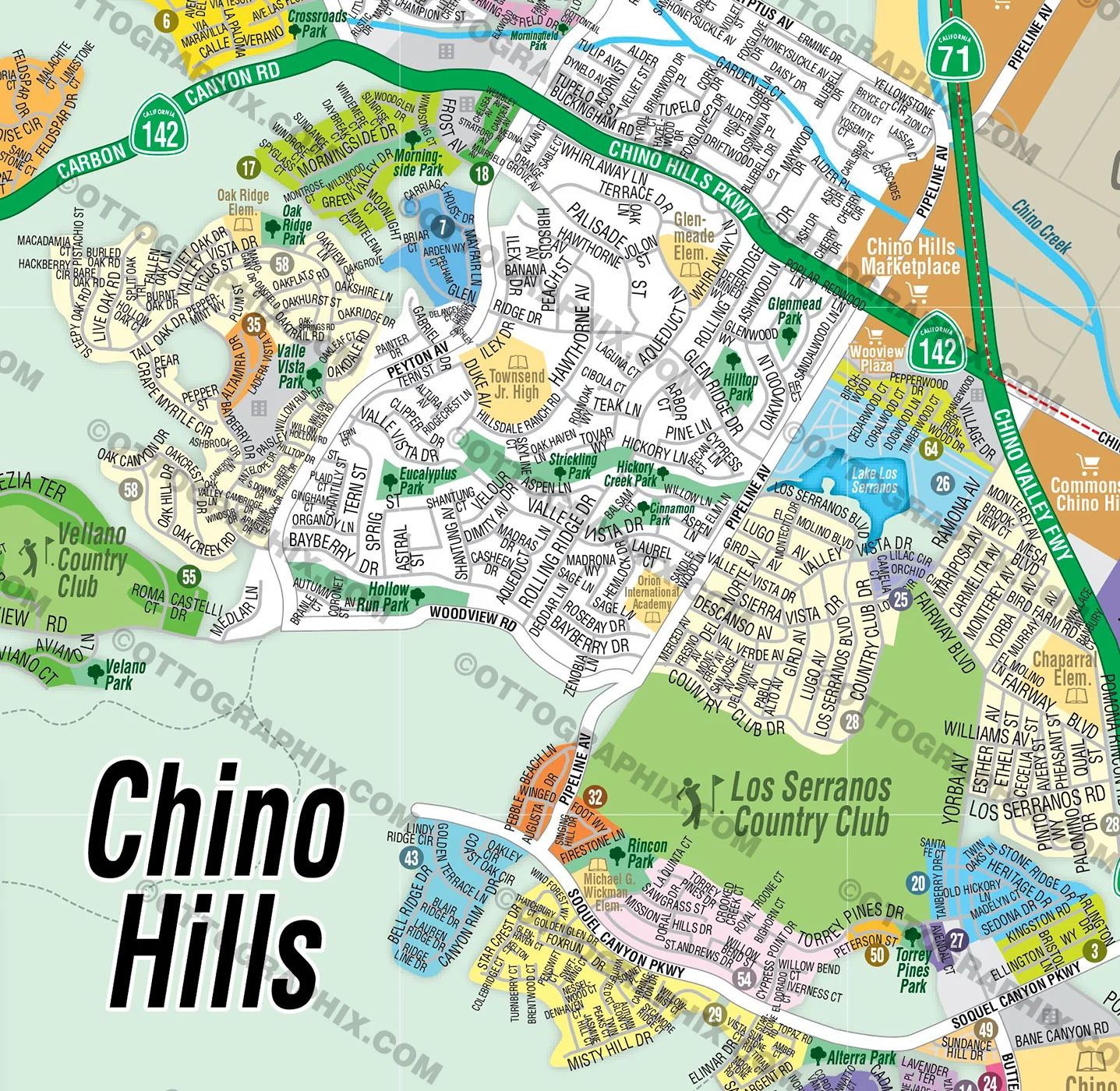
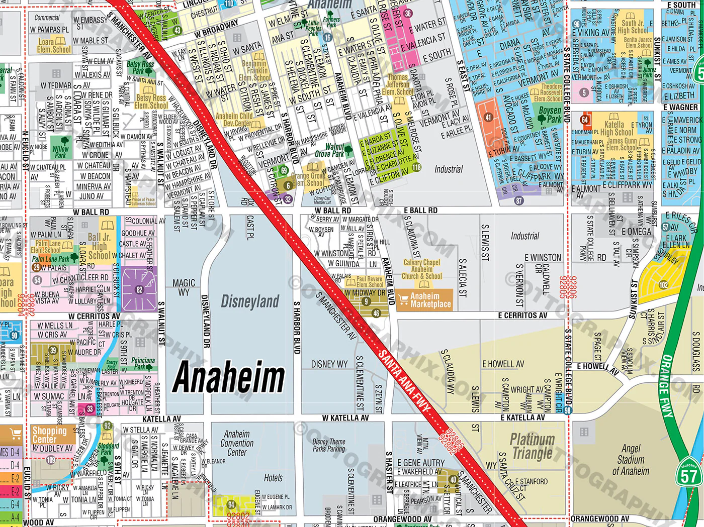
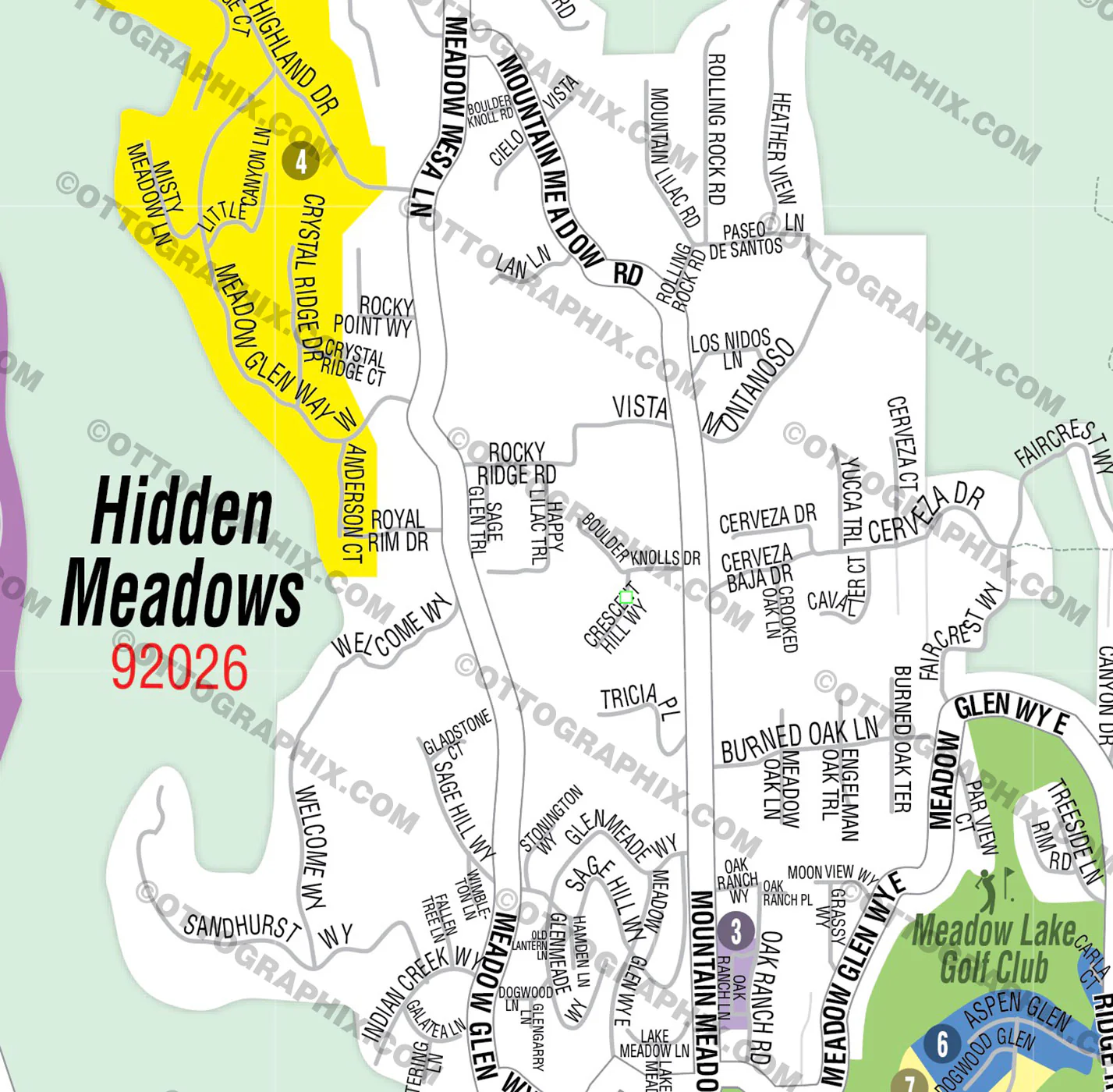
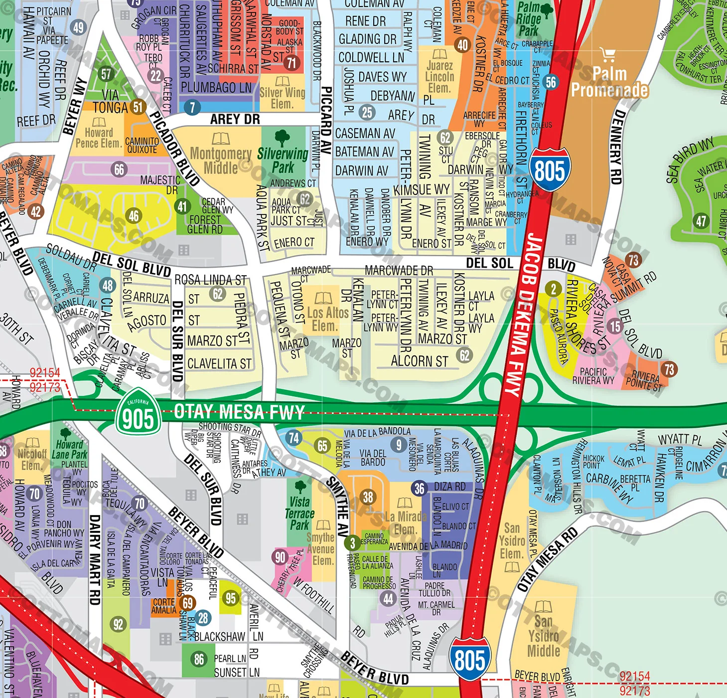
- Subdivision/Tract Boundaries and Index
- Full Street Detail
- Recreation Centers
- Parks
- Shopping Centers
- Golf Courses
- Schools
RIGHTS:
- Royalty Free
- Not for resale
- All reproduction rights granted
CUSTOMIZATION:
- Clearly labeled layers. Turn any map feature on and off.
- Maps are sold as-is. All necessary files are included for editing
- Additional customization is available from Ottographix at an additional cost. Please contact us for deatils and a free quote! http://www.ottographix.com/contact.html, 619.339.3129, [email protected]
DISCLAIMER:
The information on this map was derived from multiple sources. Care was taken in the creation of this map. Ottographix cannot accept any responsibility for errors, omissions, or positional accuracy. However, notification of errors are appreciated. If you find a mistake, Ottographix will fix it for no charge. Please contact us and we'll take care of it. http://www.ottographix.com/contact.html, 619.339.3129, [email protected]
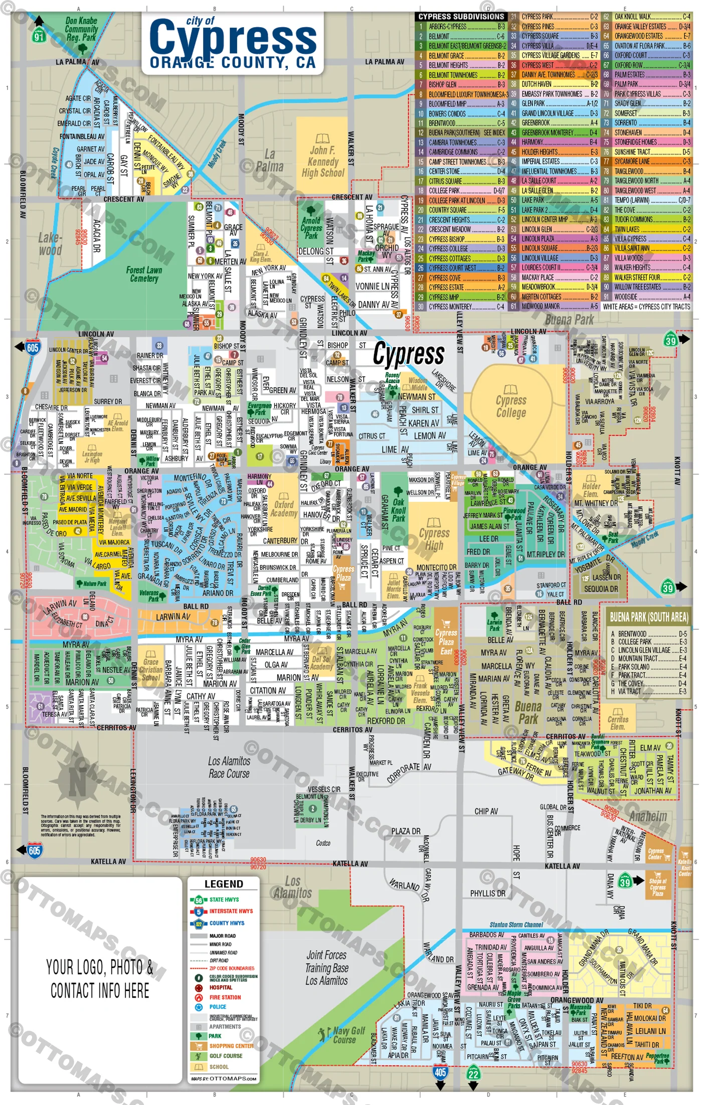
More Images
Poinsettia Park Map, San Diego County, CA - FILES - PDF and AI, editable, vector, royalty free
PURCHASE INCLUDES:
Ready-To-Use PDF with blank box for company branding, and
Layered, editable Adobe Illustrator CC file with fonts
SIZE: 11w x 17h - Vector Maps: enlarge or reduce to any size without loss of quality
COMMUNITIES:
- CANTAMAR
- CHERRYTREE WALK
- GREYSTONE COVE
- PARKSIDE
- PLUM TREE LANE
- POINSETTIA HEIGHTS
- SALT AIRE
- SEABREEZE @ MARINER'S PT.
- SEABRIGHT
- SEASIDE ESTATES
- SEASIDE HEIGHTS
- SHOREPOINTE
- THE BAY COLLECTION
- TRADEWINDS @ MARINER'S PT.
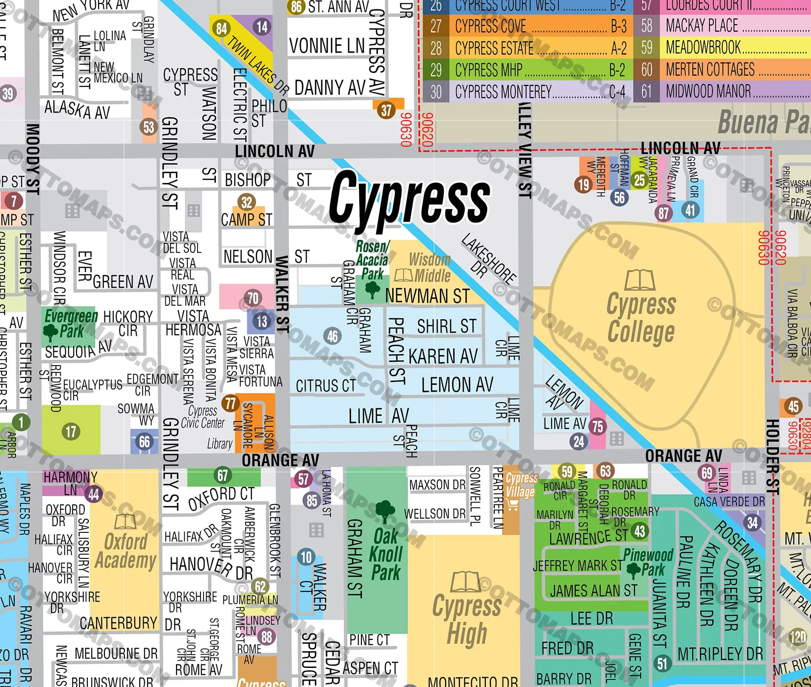
CONTAINS:
- Subdivision/Tract Boundaries and Index
- Full Street Detail
- Recreation Centers
- Parks
- Shopping Centers
- Golf Courses
- Schools
RIGHTS:
- Royalty Free
- Not for resale
- All reproduction rights granted
CUSTOMIZATION:
- Clearly labeled layers. Turn any map feature on and off.
- Maps are sold as-is. All necessary files are included for editing
- Additional customization is available from Ottographix at an additional cost. Please contact us for deatils and a free quote! http://www.ottographix.com/contact.html, 619.339.3129, [email protected]
DISCLAIMER:
The information on this map was derived from multiple sources. Care was taken in the creation of this map. Ottographix cannot accept any responsibility for errors, omissions, or positional accuracy. However, notification of errors are appreciated. If you find a mistake, Ottographix will fix it for no charge. Please contact us and we'll take care of it. http://www.ottographix.com/contact.html, 619.339.3129, [email protected]
Product Information
Product Information
Shipping & Returns
Shipping & Returns
Description
PURCHASE INCLUDES:
Ready-To-Use PDF with blank box for company branding, and
Layered, editable Adobe Illustrator CC file with fonts
SIZE: 11w x 17h - Vector Maps: enlarge or reduce to any size without loss of quality
COMMUNITIES:
- CANTAMAR
- CHERRYTREE WALK
- GREYSTONE COVE
- PARKSIDE
- PLUM TREE LANE
- POINSETTIA HEIGHTS
- SALT AIRE
- SEABREEZE @ MARINER'S PT.
- SEABRIGHT
- SEASIDE ESTATES
- SEASIDE HEIGHTS
- SHOREPOINTE
- THE BAY COLLECTION
- TRADEWINDS @ MARINER'S PT.
CONTAINS:
- Subdivision/Tract Boundaries and Index
- Full Street Detail
- Recreation Centers
- Parks
- Shopping Centers
- Golf Courses
- Schools
RIGHTS:
- Royalty Free
- Not for resale
- All reproduction rights granted
CUSTOMIZATION:
- Clearly labeled layers. Turn any map feature on and off.
- Maps are sold as-is. All necessary files are included for editing
- Additional customization is available from Ottographix at an additional cost. Please contact us for deatils and a free quote! http://www.ottographix.com/contact.html, 619.339.3129, [email protected]
DISCLAIMER:
The information on this map was derived from multiple sources. Care was taken in the creation of this map. Ottographix cannot accept any responsibility for errors, omissions, or positional accuracy. However, notification of errors are appreciated. If you find a mistake, Ottographix will fix it for no charge. Please contact us and we'll take care of it. http://www.ottographix.com/contact.html, 619.339.3129, [email protected]